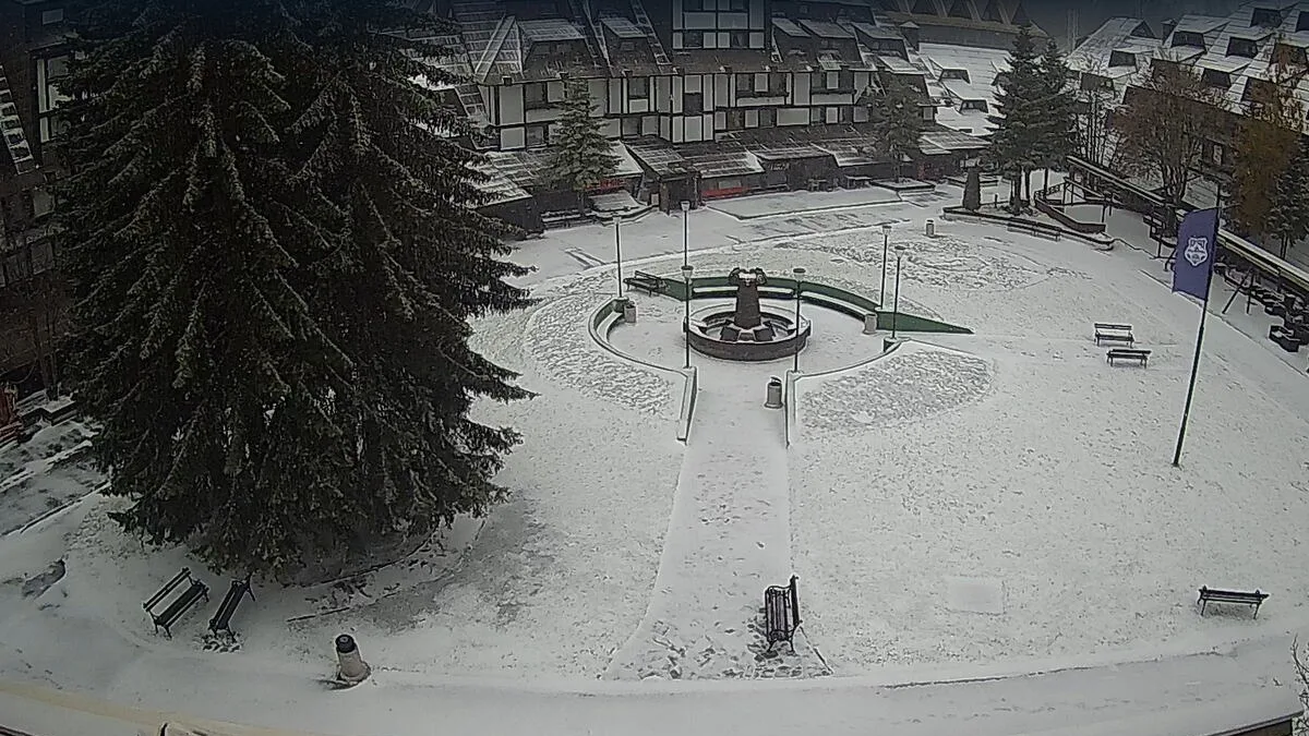
Jahorina and Bjelasnica: First Snow of the Season
The first snow of the season has fallen on Jahorina and Bjelasnica, above 1,700 meters. Tonight it is also expected on Durmitor, Bjelasica, Prokletije, Sara and peaks in southern Serbia.

The first snow of the season fell today, September 22, on mountains in Bosnia and Herzegovina, and meteorologists are forecasting it tonight on Durmitor, Bjelasica, Prokletije and Sara as well, reaching the highest peaks in southern Serbia. The amounts are symbolic, but this is the first confirmation that the cooldown gripping the region has reached the highest peaks, well ahead of the calendar start of winter.
On Jahorina, according to Telegraf, snow began falling around 1pm, above 1,700 meters. The temperature at the time was 1 degree Celsius, with a very strong north wind. Snow fell intermittently through the rest of the day, and a similar picture was expected in the evening.
The snow line dropped that same day on Vlasic too, at its highest point, Kraljica, and on Bjelasnica, where it was recorded at the Olympic Center, at 1,860 meters. BHMeteo announced the news on Facebook:
Here’s our first snow. Bjelasnica right now at 1,860 meters above sea level.
According to the same source, the snow line on Bjelasnica was around 1,800 meters today, and RTRS, citing BHMeteo.ba, reports that the precipitation will not be heavy.
Meteorologists warn that snow could fall tonight on Durmitor, Bjelasica and Prokletije as well, along with Sar Mountain and northern Herzegovina. The precipitation is spreading further east, toward the highest mountains of North Macedonia and southern Serbia, where the first snow of the season could also fall. Forecasts suggest the snow line will mostly stay above 1,700 to 1,800 meters, with a thin snow cover possible in places.
Footage from Jahorina was also posted in the meantime by the Instagram account Jahorina Prestige, confirming that the cooldown was visible on the ground even before the official weather bulletins.
The cooldown is the result of an upper-level cyclone that arrived from the Carpathian region, bringing rain, showers and localized thunder across the region, along with a strong northwest wind. Wednesday morning is expected to bring frost to the mountains and a stabilization of the weather during the day, while Thursday should bring a slight warming. Friday brings a new, brief deterioration, and a longer warming spell is forecast from the weekend.
Daytime temperatures in lowland areas will range between 15 and 20 degrees, in the mountains between 5 and 10, while the southern Adriatic coast will still see highs of up to 25 degrees. This year’s first snow is arriving on the last calendar day of summer, which is not unusual for the region’s highest peaks, even as the lowlands keep recording summer temperatures.